
Mulberry Gap Adventure
The devil went down to Georgia … and invited two of us to come with him to ride gravel!
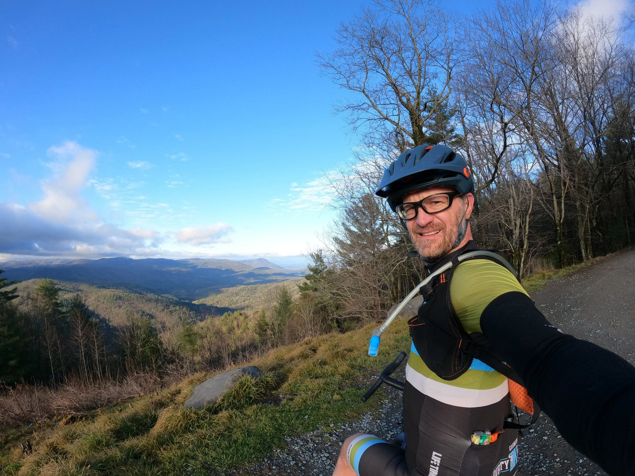
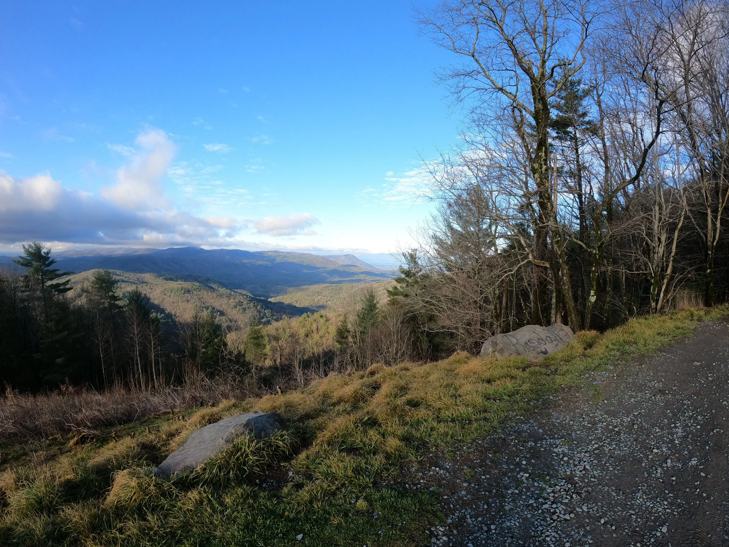
Big climbs = big views
We somehow got it in our heads that going down to Georgia for a three day training camp sounded like a good idea. Only Rodney Reed and I could make the logistics work — the rest of the group had regular, adult-like things to do.
We drove down to northern Georgia to base out of Mulberry Gap Adventures. The drive each way is about 7 hours from Columbus, not horrible distance. MG is a “glampground” for mountain bikers and gravel riders. They have small, but cool cabins, trails on site, bike wash stations, running water and electricity, tent spots, and a mess-hall with breakfast and dinner home cooked meals. The setting is decidedly “mountain rustic” with no cell reception and only modest, semi-reliable internet service. Never fear, Ellijay GA is just a 20 minute drive away with all the modern amenities of a mid-size town and a cool outdoorsy vibe. The people who run MG are dirt baggers themselves, and they run an awesome facility. The camp store looks almost like a fully stocked bike shop and everything I saw at the basecamp was super clean and in proper working condition. You can tell the owners really care about the campers experience and go out of their way to make it as awesome as possible. I highly recommend MG as an anchor point for anyone wanting to sample Northern GA big mountain gravel and mountain biking. As a plus, the TNGA race goes right by MG as does the Cohutta 100 (on some years). The Southern Cross race is just 50 minutes away.
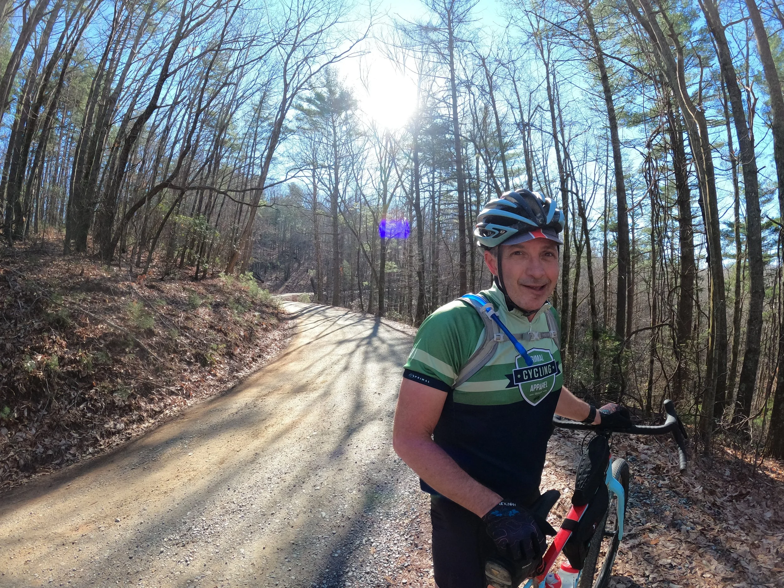
Sinewy gravel roads
Day 1: On our first day, we parked our car behind the US Post Office in East Ellijay (there is designated long term RV parking) and rode out to do parts of the Southern Cross race course. We had about 20 miles of mostly paved hilly riding to get to the good gravel. Note: the two miles on SR 52 is kind of busy and there is a smallish shoulder, so be prepared to endure a couple of minutes of not-so-pleasant riding.
Once we hit Forest Service Roads, we were on remote-feeling, cool gravel and dirt roads for a long time. We passed the trailhead for Springer Mountain on the Appalachian Trail and saw a lot of thru hikers starting their journey to Mt Katahdin in Maine. The climbs here range from reasonable (5% to 9%) to difficult (12% to 18%). I was surprised by how much climbing was steep. Unlike OH where the climbs are steep and short, these climbs are steep and long. We had two climbs on the day that lasted 5+ miles each.
We hit up a local hamburger shop for a late lunch just outside of Dahlonega. After lunch we had our toughest challenge of the day on Forest Service Rd 55 (aka Grassy Gap Rd). It was an unmaintained road with deep washout ruts and it was steep (12%) and long (about 7.5 miles total climbing). We slogged up this technical ascent for about an hour.
We ended the day with 93 miles, 10,200’ climbing, and a 12.2mph average. The day started off a bit chilly at 46, but warmed up into the upper 60s for most of the day with a couple of spots in the 70s. We made it back to the van about 90 minutes before dark and had a great, protein-rich dinner at a Japanese Steak house.
Day 2: The second day featured a huge T-storm moving through the area. Rodney risked it and snuck out for a quick ride in the morning before the storm hit. I went into town to read and eat. I stopped at the local bike shop in Ellijay (Caternary Bikes) which is stocked with high end mountain bikes. They graciously replaced my brake pads which I had eviscerated the day before on the steep descents.
The Cohuttas
Day 3: Our third day (second day of riding) featured the “Queen Stage” of riding the Cohutta 100 mountain bike course. Mulberry Gap is right at the midpoint of the course, so we would be starting in the middle. Not every Cohutta course comes down to MG — this particular variant is known as the “Gravel Death March” because of the long out-and-back segment of gravel roads with extreme climbing down to MG and then traversing those same roads back North.
We started the day with the monster climb up the backside of Potato Patch Mountain. It took us about an hour to climb 1900’ in 5 miles. A lot of the roads were steep pitches of 13% or more. I was conservative in my early morning pace; I am sure Rodney could have climbed that same ascent considerably faster.
After Potato Patch climb, we had about 20 miles of up/down gravel forest service roads. Unlike the Ohio up/downs which are usually about 1/2 mile long and 200 vertical feet, each of these up/downs was about 500 or more vertical feet over a mile or so. BIG. STEEP. RELENTLESS. CLIMBS. It was going to be a hard day.
We saw a couple of other cyclists up there, especially as we got closer to the Ocoee White Water Center (think Atlanta Olympic whitewater) and several jeep and 4x4 enthusiasts. The temps at the basecamp were a nippy 40deg at the start. I made the mistake of thinking things would warm up quickly on the big climb, so I wore my summer kit with short fingered gloves. While the climb was warm, on top of the mountain it was about 34 deg for another hour or two. I was a frozen popsicle and had a hard time braking with numb fingers.
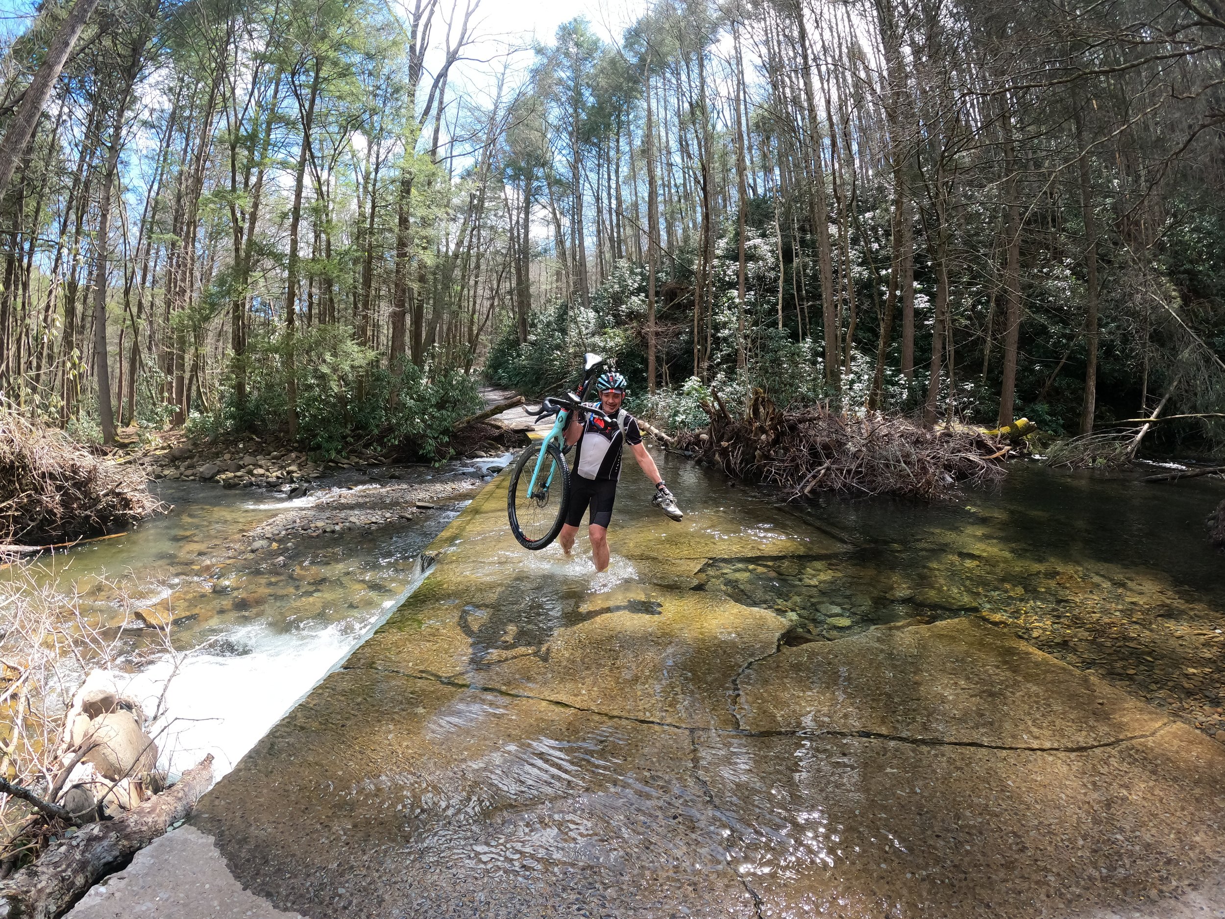
Chilly water crossing required us to take off shoes and socks.
We had a 20 mile stretch of abandoned FS road that was constantly up/down albeit as a smaller scale. We had a deep water stream crossing and because of the cold temps, we elected to take our shoes and socks off to keep them dry for the rest of the day.
We finally dropped down onto pavement and had a 10 mile ride into Ducktown for lunch at 2pm. We realized that dinner was served at basecamp at 6pm and then had to hustle to get back in time.
Hustle we did, continuing the theme of relentless climbing and traversing the gravel death march loop back toward the south and Mulberry Gap basecamp. We opted to cut part of the route off at the end (an optional 10 miles extra) and managed to pull into camp just as dinner was being served.
This day was 89 miles and 12,500 feet of climbing. Even by Ohio’s hilly standards, this is a hell of a lot of climbing and we felt every bit of it. I managed a slothenly 10 mph pace.
I must add that the people in Georgia were super friendly to cyclists. Drivers were patient, kind and made safe passes. There was almost no hint of aggression, even with big pick up trucks driven in remote Appalachian Rds. There were no political ads hanging in peoples yards. There were no confederate flags anywhere. And we got chased by exactly 0 dogs in over 180 miles of backroads, rural riding. People were just kind and respectful to each other in a way that I had totally not expected. It really speaks volumes about the kind of hostile encounters cyclists regularly have in rural Ohio that is not at all part of the Georgia culture.
Here is the full YouTube video link below: