Keystone Gravel 2021-Jersey Shore PA RECAP
This event is a gran fondo style; no mass start and no timing of the entire ride. Strava segments are used to determine the podium. Rod and I camped at Little Pine Creek State Park; very peaceful park with beautiful pines. The start was 20 minutes away and ends up going past our camper. The morning was 49 degrees when I woke and ended up being in the high 60's; a perfect weather day. The route is 80 miles; with two cut off options. I had hoped to do the 80 miles, even though this ride is listed as an "adventure" or "grinduro" type of ride. Very casual check in; not even a # to put on the bike. The farm start and finish looked very nice with tent camping available.
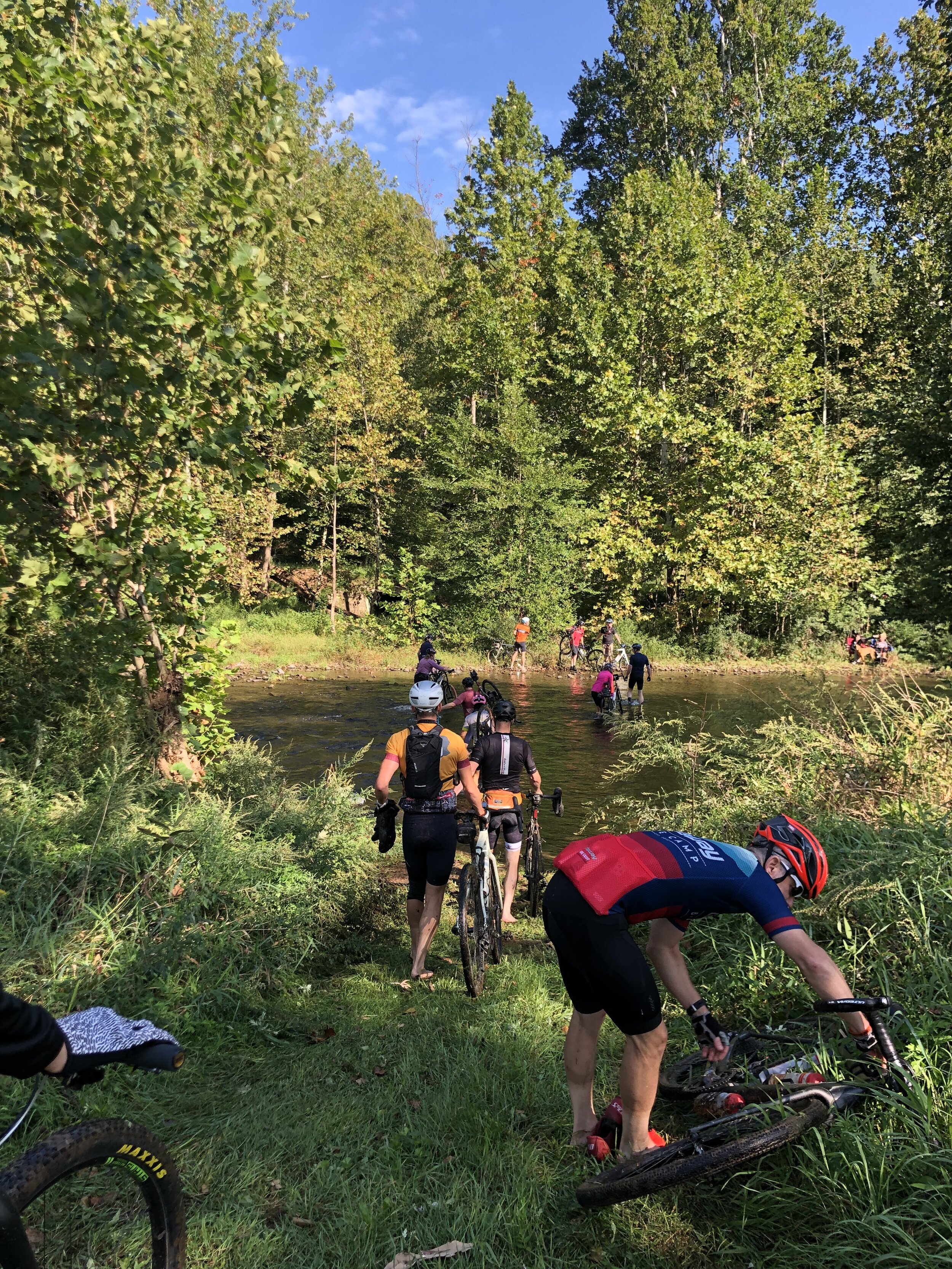
At the start, you are on pavement for half a mile and then go onto one of many off road tracks. We headed into the campground, eventually on a gravel road, and stopped at the dam for pictures. At this point, RWGPS took you on the paved road to the next turn; I noticed several riders taking the Lake Shore trail and decided to do that, not my smartest move. We had to cross the creek at the end of the trail and water was mid thigh (on me anyway). I carried my bike, incorrectly, and the front wheel dipped into the water. The small current was making it that much more difficult to cross and a nice young man helped me to get the bike on my shoulder. Same guy came back into the water, towards the end, and took my bike from me. Had he not, I think I would have fell in. That would have made for a very chilly ride until dried out. Grateful for his assistance for sure! If there is a future for me on this ride, I would not take that trail next time, stay on the pavement and there are plenty of other off road sections to come. There are four Cat 3 climbs on the route; our next turn had one of them. They are mostly 1.5-2.5 miles long with ascents of 1,000' all were on gravel roads. After this long climb, we headed onto Callahan Trail; a mountain bike two track that was mostly downhill. I stayed to the right, to keep out of the way of the real riders, as I was slowly making my way trying to stay upright. Aid stop #1 at the end of this trail (mile 25) served noodles, potatoes and pickles. Strange menu, but the noodles did hit the spot. The 2nd shortcut was 10 miles away and I figured I decide when I got there what to do. I managed to miss the cut off and when I got to mile 40 and it had taken me 5.5 hours, I decided I better take the 2nd short cut. I backtracked a half mile and found Robbins Run Rd; a forest road that dumped you onto a grassy single track. At this point I don't have routing, since this is a short cut. It looked easy on the map, but I was a little scared I was off the short cut trail, not sure if anyone could find me if they needed to. Eventually found my way back on route and continued on to Aid stop #2, only two stops for the entire route. Aid stop #2 was at a bar/restaurant and had lots of cookies; every so often a server would put a pizza out and the masses would converge on it. Left Aid #2 on a paved road, route took us onto the Haneyville ATV trails about 1/4 mile down the road. I noticed some did not take the ATV trail and continued on the pavement. Those last 20 miles were mostly jarring trails, tracks and rocky paths. Not sure that I have ever been so happy to be on pavement again. From looking at Purple Lizard maps and the route, I'm guessing we had 3 miles of paved, 20 of gravel roads and the rest of my 65 was on "adventure" roads/tracks. I was able to stay on my bike more than I could on Rollin Coal, but there was more of the adventure parts on Keystone. A mountain bike would be better suited for this route. That said, the route is a beautiful relaxed pace ride, with very few cars It's quite challenging (8100' of climb in 65; 10000' in 80 miles) made more difficult due to the terrain.