Recap: Millersburg-Coshocton Overnighter
82 miles
June 22-23, 2021
This exploration of the backroads of Holmes and Coshocton counties was about 50% gravel and 100% scenic. Stew Freedman and I left a car at the Millersburg Walmart and took off on a credit card tour to Coshocton. Stew was riding his Salsa Cutthroat and I was riding my Niner RLT-9 aluminum. Prior to riding we stopped at the Jitters Coffee Shop across the street from Walmart to get caffeinated.
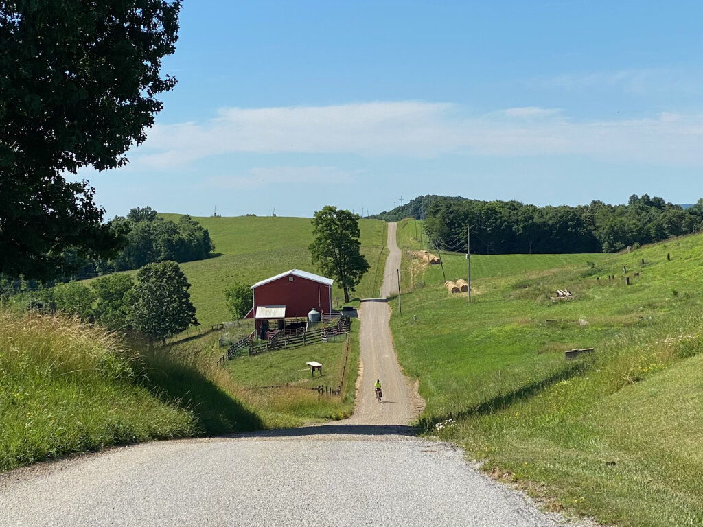
Riding east out Millersburg on CR-58 we turned onto TR-129 and the pavement soon turned to gravel. A left onto CR-407 (asphalt) took us into the very small town of Salito. The total climb from the parking lot was almost 400 ft with the steeper pitches on gravel at 8-11% grades.
After Salito we turned south and gravel started at about mile 5 and continued with pavement only on a couple of very short sections (and in front of houses) until mile 22.5. This section had several smaller climbs and down hills along with about a 5 mile long plateau. The only traffic was an Amish buggy, a few Amish on e-bikes, and a couple of Amish kids on pedal bikes. No dogs, a few donkeys, one horse drawn plow in action were pretty much all the animals.
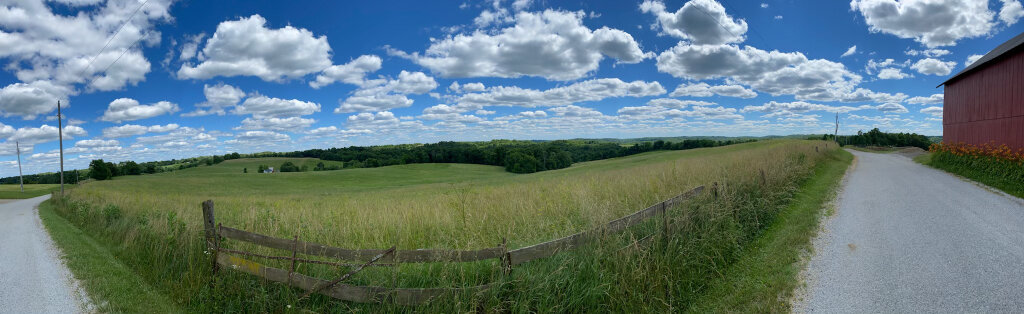
The descent off the plateau was 7-11% and led to a long gravel section along the Bucklew Run at which point we hit CR-24. From there we worked our way over to Warsaw where the first services of the ride were available at Shopwise (bottled water was only $.50!). This section did go along US-36 but traffic wasn’t any issue. From Warsaw we again headed south on SR-60 and got back on gravel on CR-17 at mile 30 where we had a 7-11%, 250 ft climb up to the top of the ridge where we found perhaps the best scenery of the day. The descent off the ridge was fairly steep and led us back to US 36 for the final ride into Coshocton. Being later in the day we hit heavier traffic and got buzzed pretty closely by one unenlightened driver. US-36 into Coshocton can be avoided by staying on CR-55 all the way into Roscoe Village on the outskirts of Coshocton. It will lose about 2 miles of nice gravel riding but some will prefer staying off US-36.
A must stop in Roscoe Village is for ice cream at McKenna’s Market. We stayed at the Coshocton Village Inn and Suites. Camping is available at the Coshocton Lake Park which also has a full sized swimming pool. Dinner was at Warehouse Restaurant (a.k.a. Steak and Stein) where they have excellent outdoor seating and a good beer selection.
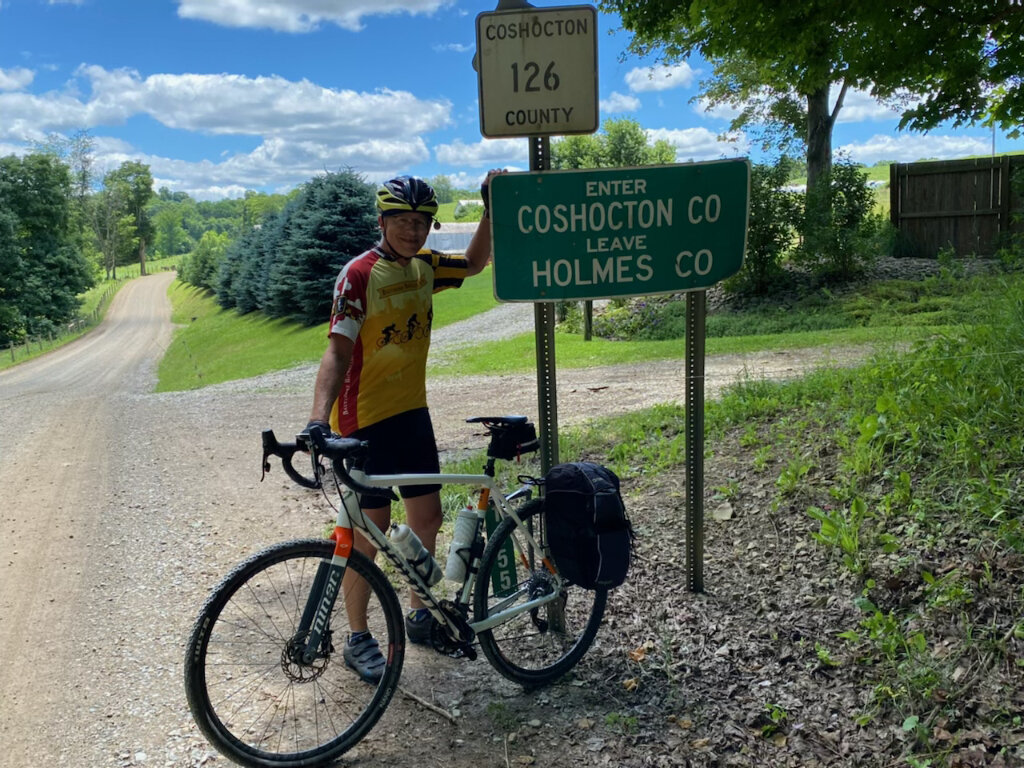
The return route to Millersburg ran to the west of the first day’s route. The initial 12 miles were mostly on CR-24. Note that traffic on OH-83 prior to CR-24 was pretty heavy- this can be cut a bit by going through Roscoe Village then using paths to get to the Lake County Park. CR-24 is a gem. I’ve ridden it several times and there is excellent pavement and virtually no traffic. As a bonus there is a 225 ft climb with some 7-9% grades to warm up on.
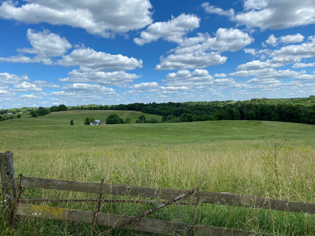
At Metham (no services) the route goes on OH-60 for a half mile then turns on TR-31 where the road turns to gravel with a 274 ft climb that has steep 8-12% grades in places. The next several miles are along exposed farmland with excellent views. We stopped for snacks at the turn for CR-33 and a couple of friendly dogs came out to say hi and beg for treats. A descent on TR-330 tested our brakes and ability to stay upright with fresh gravel and grades of 9-13%.
The next 10 miles took us along a valley floor which included some gravel not marked on the map. A hard left on TR-312 rewarded us with additional gravel. First services can be found at a Sunoco in Clark. Note that the left turn onto SR-83 brings some fairly heavy traffic. We also had some large trucks along CR-150. These two sections could be avoided by turning onto TR-19 at mile 22.5 (but then no services). Make sure to stop and see the artwork on the Legends of Music Barn.
A steep descent down to Laurel Creek is followed by the biggest climb of the trip- 357 ft with 7-9% grades up a shaded ravine. After breaking out into open fields, there is a long downhill with 379 ft of descent that ends in the town of Kilbuck. Kilbuck has several small restaurants- we had some pretty good club wraps at the Snowside restaurant at Front St. and the Amish Country Byway downtown. After Kilbuck the route goes onto the Holmes County Trail which has separate lanes for horse and bikes / walkers. The ride ends at the entrance to Walmart.
We were lucky to have cool 60’s and low 70’s weather as we both made do with 2 bottles of water a day. In hotter temperatures I probably would carry four bottles. If you run out of water there are a lot of houses along the way- I’m sure someone would take pity.
In summary- this was simply an all around beautiful route to ride. Traffic was light for the most part and we didn’t get chased by any dogs. I was really impressed with how well kept all the houses along the way were. As a bonus we saw many other gravel roads that need exploring!
SR: State Route CR: County Road TR: Township Road US: US Highway