
Recap: Cross Florida - The Tale of Two Dana’s
Overview
My wife and I spent about a month roaming around Florida visiting friends and family while also spending some time on our own. We met up with my childhood friend Dana Farnsworth and his wife Kelli who live in Dunedin, Florida. The other Dana and I have known each other since 6th grade and grew up about 5 houses apart until we graduated high school. Dana is a bike enthusiast too, so we decided to do a coast-to-coast ride. As usual, my wife Robyn was kind and volunteered to SAG for us. We stayed in hotels along the way then Kelli met us in Flagler Beach, and we all spent the weekend in St. Augustine before they headed home, and we continued our Florida nomading.
I designed this route based off of a race held by Singletrack Samari, who has an amazing website that has bike, bikepacking, gravel routes and events all over Florida. Karlos Bernart has done an outstanding job documenting and sharing this information, so I highly recommend starting at his site if you are interested in riding in Florida. Singletracksamari.com The race is called the Kings Highway race and is a continuous 200 mileish route done in one single ride. We wanted a slower pace so we could enjoy ourselves and our surroundings each day. I modified the route to remove some remote sandy sections that would have been too difficult for our gravel bikes on 40 mm and 42 mm tires. We split the route into four days approximately 50 miles each starting in Steinhatchee on the west coast and ending at Flagler Beach on the east coast.
Day 1
53 miles 502 feet of elevation


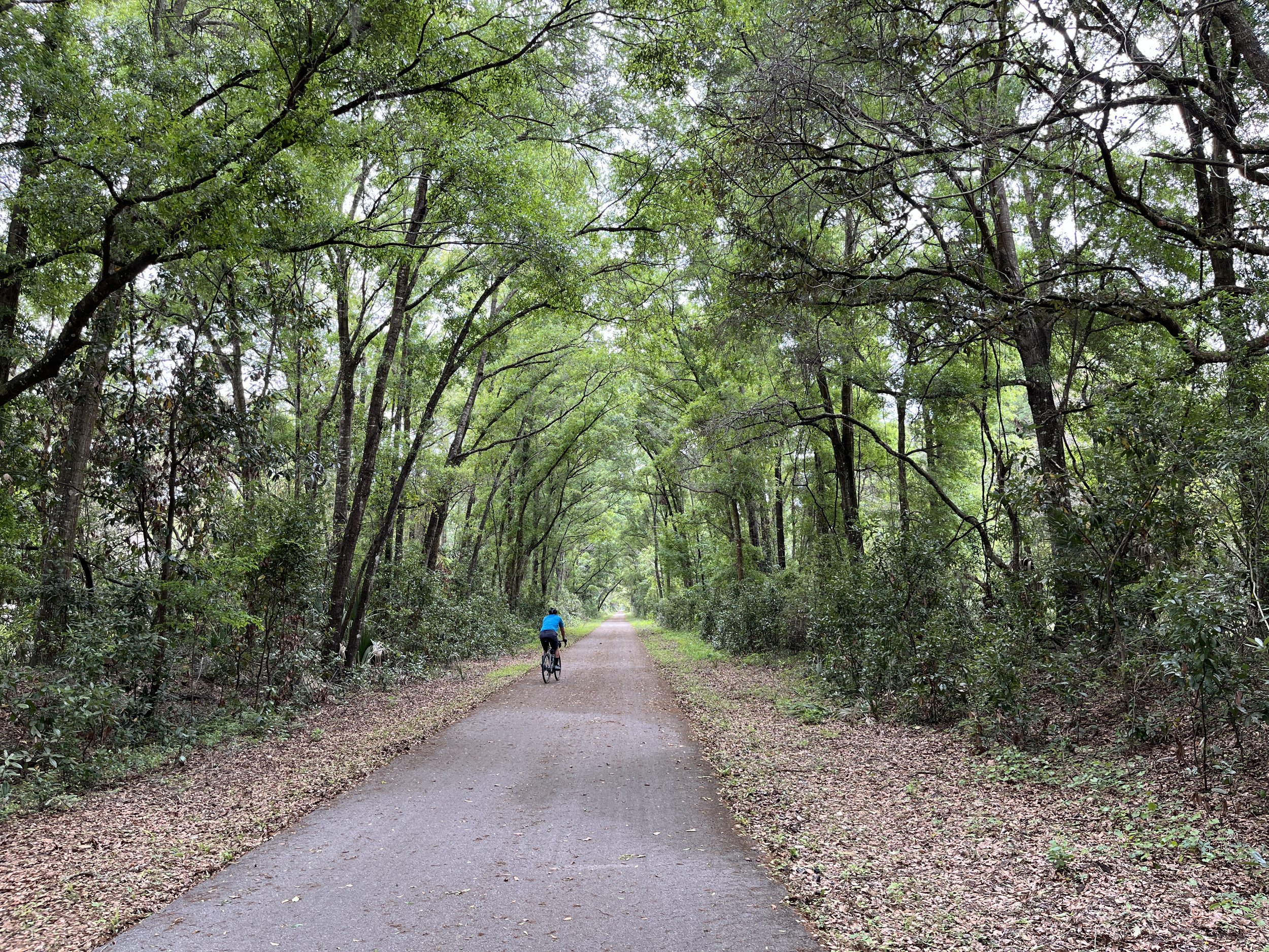
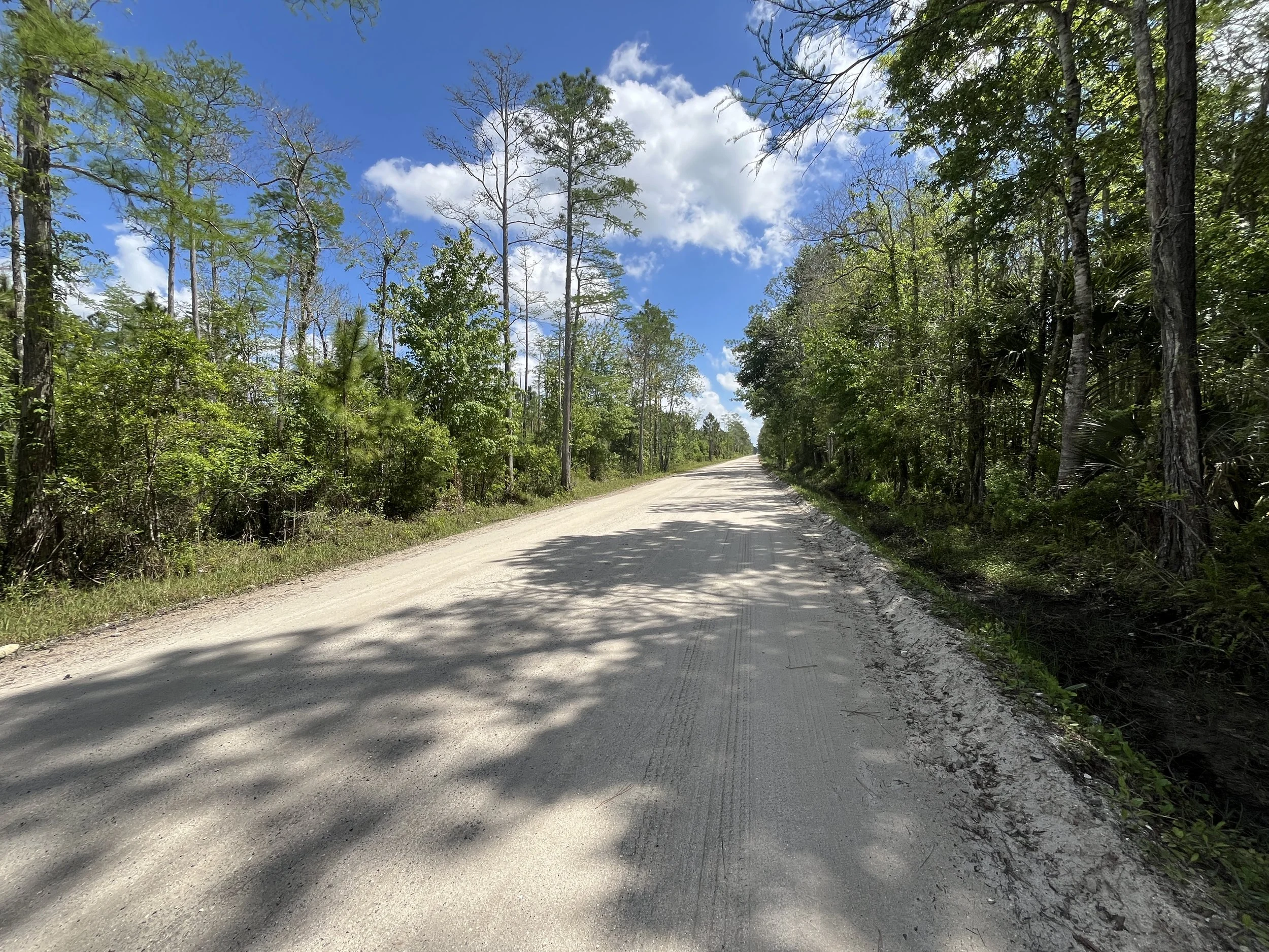
We started the first day of our adventure in Steinhatchee and ended the ride in Chiefland. We traversed some very remote forest areas on the western coast of Florida and pretty much agreed that we had found the middle of nowhere, which is actually pretty hard to find in Florida. We even saw a bear. We were also fortunate that the forest roads were very compact sand and limestone making the riding very enjoyable.
Steinhatchee is a small remote fishing village on the west coast of Florida. There are a few new houses being built but it still feels like a small isolated community focused on fishing, unlike most of the rest of Florida, which is pretty much either for sale, being developed or has been developed. There are several marinas with outdoor bars providing a nice laid back place to enjoy the natural surroundings while enjoying some drinks and eating decent food. We might have to stay a little longer in Steinhatchee the next time we visit Florida.
We stayed at the Fiddler’s Restaurant and Resort. The rooms were OK for one night right before you start a bike tour, but the next time we stay in Steinhatchee we’ll probably find a different location.
The highlight of the trip was the three water crossings. We saw them on Google Maps satellite view but had no idea how deep or challenging they were. At the first crossing we could see that it wasn’t very deep so we both just rode across the water without issue. At the second crossing, the pool of water was very large and we tested the depth by throwing some large rocks up in the air and watching the splashes. It seemed deep so we had a bit of a discussion on what to do. Since I developed the route, I figured I needed to figure it out so I took my socks off put my shoes back on and just wadded across the water. I found out that as long as we stayed to the right side of the pool the water never got higher than my calves. The other Dana decided to go for it and after he successfully crossed, I followed. The last crossing had big rocks in it so with my skinny tires I decided to carry my bike across though the other Dana crossed it on his bike with only a few sketchy moments.
With wet feet, we continued on down some very remote and beautiful state forest roads. We saw two vehicles the entire time we were in the deep forest. As we got closer to the end where we intersected a paved road, we did meet a couple of more vehicles.
We crossed the Suwannee River on the Florida Nature Coast Trail and then diverted about 10 miles off of the route to Chiefland where we spent the night in a Quality Inn.
Day 2
4 miles and 52 feet of elevation


Our original plan was to ride from Chiefland to High Springs. However, the weather forecast called for severe weather for a large portion of the day. The night before our ride, all three of us constantly watched as many weather forecasts on TV as possible and backed that up with our weather apps. The forecast wasn’t looking good, so we decided to make a final decision the morning of the ride.
That morning, multiple weather forecasts, three separate weather apps, and even the national weather forecast were all predicting that the severe weather wasn’t going to show up until closer to noon. Based on the information we had, we all agreed that we should give it a try. To increase our chances of finishing before the severe weather hit, my wife agreed to take us back up to Fanning Springs where we turned off our route the previous day to get to the hotel. This would save us about 10 miles of trail that we had already ridden.
To paraphrase Mike Tysyon - “everyone has a plan until they get hit in the face”. And boy did mother nature hit us in the face. We started riding around 8AM and within a mile or so we started seeing some very dark clouds coming in from the west. Soon after, we heard a couple of rumbles of thunder and by the time we got two miles in we realized that we had probably made a mistake as the thunder started increasing and we started getting rained on. It wasn’t heavy rain, but we could tell that it was going to get worse. So, we made the decision to call Robyn and have her meet us at the trailhead where she dropped us off. She had just turned back into the hotel parking lot when we called, so she immediately turned around to meet us.
The other Dana and I put on our rain jackets and started heading back to the trailhead. We didn’t get very far when the sky fell out and we got belted with a torrential downpour. I’ve been in this type of rain before, so it wasn’t that big of a deal especially since we were so close to getting picked up. Then all of a sudden, I saw a huge wind shear blowing across the trail in front of us so I told the other Dana to stop. You can watch the attached video and see how intense this was, but I have to say it was probably the most dangerous situation I’ve ever been in on my bicycle. If we hadn’t stopped, I truly believe we would have been blown over.
The wind eventually died down enough so we could continue down the path dodging downed branches and debris finally reaching the truck. There was a lot of lightning in the area, so we left our bikes leaning on the side of the truck and jumped into relative safety. Once the storm died down a bit, we were able to load the bikes and return to the hotel. I don’t think I’ve ever seen so many different weather forecasts be so wrong. I’m normally pretty conservative when it comes to riding in severe weather and based on all of the information we had, we felt we were good to go. There was a chance of getting rained on, but the severe weather in the morning was not predicted by anyone.
Since the forecast was now calling for continued severe weather, we decided to scrap the day and we all drove to High Springs, which was our next overnight stay on the route. We stayed at the BlueGem Motel. The BlueGem is an old motel that has been revitalized and modernized and was actually quite nice. My wife and I have stayed at several of these types of motels over the past several years and most are actually good. They each have their own personality and they are very convenient for bicycles as you pull your car or your bike right up to the door and it’s easy to get your bike in the room out of the elements.
High Springs is a nice little town with a restored downtown area with several shopping and dining options. We enjoyed a nice meal and some drinks at the Great Outdoors Restaurant in downtown.
Day 3
51 miles and 600 feet of elevation


Our third day took us from High Springs to Palatka
The weather forecast was still predicting heavy rain well into the morning so we decided to wait for the rain to pass then have Robyn drive us out of town a few miles so our daily mileage would be close to 50 miles.
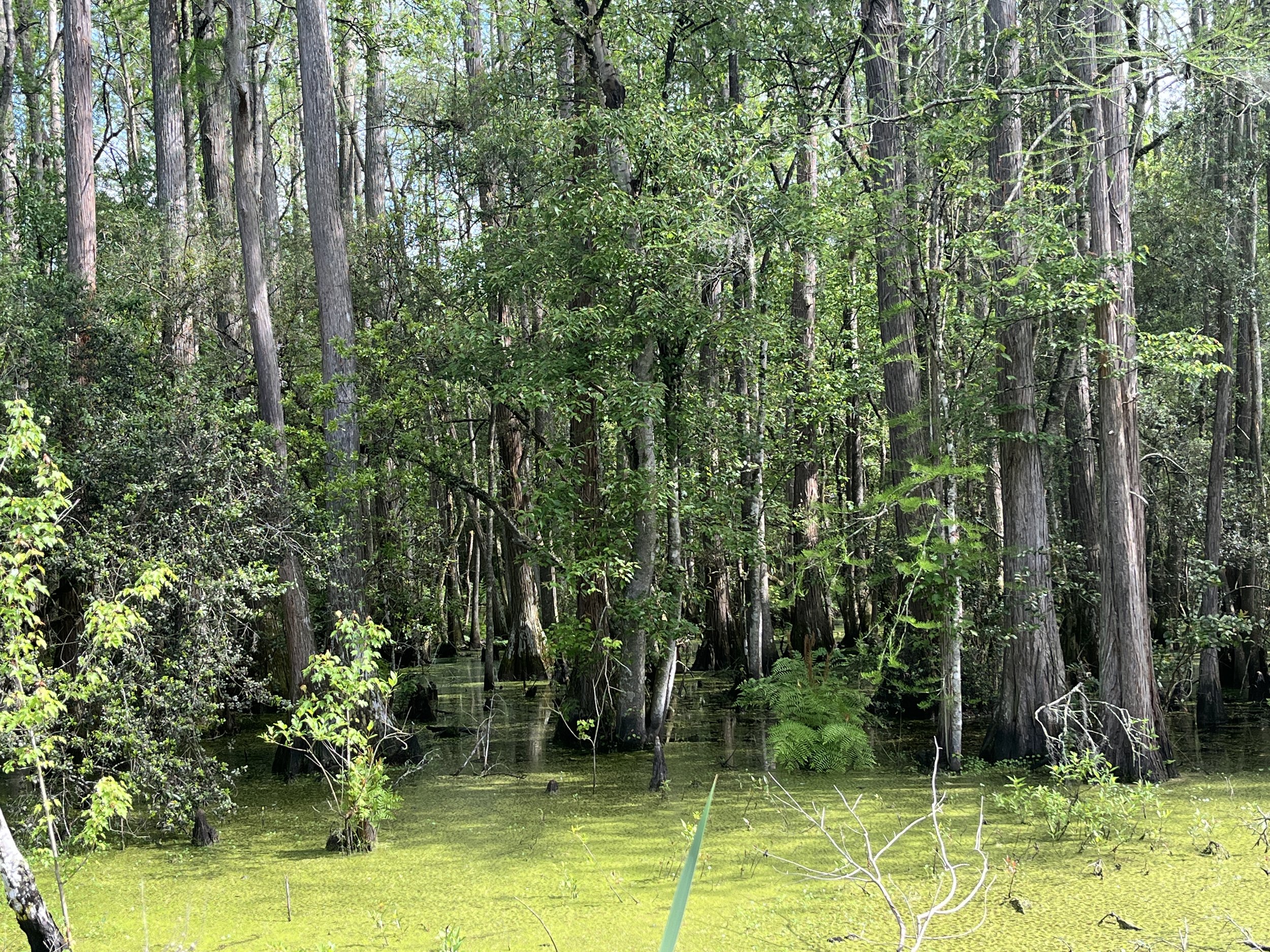
The rain passed and we were rewarded with a beautiful day and some really nice riding on Palatka bike trail. The route originally had us riding on several dirt roads but due to the huge amounts of rain they were in very bad condition, so we decided to just stay on the paved roads and bike paths. This day of the route was fantastic with some great swamp, lake and forest views with the last 30 or so miles on the Palatka bike trail all the way to the Quality Inn on the St. Johns River in Palatka.
We both had a very good grilled cheese sandwich for lunch at Clydes Cozy Corner Cafe in Keystone Heights. We ate outside basking in the warmth of the sun and enjoying the bright blue skies after a day and a half of heavy rain. We even had a little Star Wars discussion with our waitress after noticing that her shirt and apron obviously indicated she was a huge Star Wars fan. Who is your favorite character and which movie is your favorite?
Day 4
43 miles 460 feet of elevation


Our final day took us from Palatka to Flagler Beach.
It was another great day of riding with amazing weather. We had a bit of every type of surface including dirt, sand, brick, two-lane low traffic back country highways, busy two-lane highways and very busy four-lane highways. Both the other Dana and I thought this was the best day of the route.
I got up early and got a great view of the sun coming up over the St. Johns River. Since this was going to be our shortest day, the other Dana and I decided to have breakfast at Angel’s, which is Florida’s oldest diner. The food was good, the atmosphere was very interesting, and the prices were reasonable. So, after filling our bellies, we took off, climbed the bridge over the St. Johns River and quickly entered the farmland east of Palatka. We rode over several old brick roads around agriculture fields finally peeling off a two-lane highway and entering a remote area with dirt paths and a man-made canal. There were a lot of animals and we even saw a barred owl as we exited the canal area and entered Flagler Estates, which still has some nice dirt roads.
We took a break at the Buzz Mart, the local convenience store, near Flagler. After our break we experienced the highlight of the day, which was riding approximately 10 miles on the Old Brick Road. The Old Brick Road was part of the original Dixie Highway and this small section is now a Florida Scenic By-Way that goes through lowland swamps. The road is completely brick but over the years has been covered with what they call sugar sand in Florida. Sugar sand is a very fine sand that is also very hard to ride a bike on. Luckily, for the majority of the road the brick is still visible in the middle of the road, which makes for a pretty nice ride. However, as we got toward the last few miles of the road the sand got very deep and covered the entire road. The other Dana was able to ride his bike through it all, but I was not able make it. I ended up hike-a-biking for a mile or so, which wasn’t that big of deal because I’m pretty used to hike-a-biking.
We ended the day on the Lehigh Bike path that meanders it way through beautiful forest and swamps finally completing our ride at Flagler Beach on the Atlantic Ocean.
We met Robyn right at the beach and then had a couple of drinks at Tortugas Florida Kitchen & Bar reminiscing about our recent accomplishment and admiring the beautiful ocean. We finished our drinks, loaded up the truck and headed to St. Augustine for the weekend where Dana’s wife Kelli was meeting us.
Gear Review
Schwable Marathon Plus Touring tires – I was riding on 40 mm tires and Schwable markets this tire as one of the best puncture resistance and durable tires available today. That design, in my view, also creates some interesting riding characteristics. I believe the sidewalls are very thick and overall, the tire is heavy. I noticed that when riding on rougher terrain the tires feel bouncy. It’s not horrible, but I noticed it compared to other more supple tires that I’ve ridden. Additionally, the tires were almost completely useless in moderate to heavy sand. They have a hard time riding on top of the sand even if you let a significant amount of air out the tires. Again, this may be due to the heavy sidewalls and the inability of the tire to deform and get wider with low tire pressure. The best characteristic is that durability, and I was able to set them up as tubeless even though they are not designed for it. Another benefit is I never had to add air to the either tire during the whole trip. This is far different than most other tires that I run as tubeless. I think their durability will outweigh the bouncy house effect when I ride on much longer adventures in the future.
The HOVERAir X1 Drone - The other Dana brought a small and pretty amazing drone along so we could get some video footage from a different perspective. I have to say I was impressed as the drone is supper small, light and is extremely easy to use. Hover describes the drone as follows: “The HOVERAir X1 is a lightweight, portable, and user-friendly drone that provides an excellent alternative to typical drones. Its ultralight weight of 125g means that it doesn't require registration or certification, and it can be easily launched with a 3-second palm takeoff, in contrast to typical drones, which require manual takeoff. The foldable design allows it to fit in a handbag or pocket, making it a great option for on-the-go use compared with typical drones. Its 5 pre-programmed flight paths, including Hover, Follow, Reveal, Orbit, and Overhead, allow for hands-free cinematic shots. Not to mention that the fully enclosed frame offers absolutely worry-free flying.” DCRainmaker also did a great review on the drone if you would like to learn more about it. You can see the review here on Youtube.