
Recap: 2019 Vermont Bikepacking
The Green Mountain Gravel Growler Grinder route from Bikepacking.com inspired us to head to Vermont. Big thanks to Doug Fisher for developing a shorter route that would work with our daily mileage and camping requirements. Thanks to Tim Cristy for tweaking the routes further and staying vigilant for weather and route conditions. Day 2 required a reroute around a recent landslide which closed Cottonbrooke Road.

Heading into Montpelier, VT • Photo credit: Ray George
General Observations
Around the equinox the sun rises at 4:30am and the birds are awake and yelling at each other. The Vermont countryside is pleasantly absent of chain restaurants. Everything is local with fresh cheese, bread, meat, eggs readily available. We were warned of the black flies, but mosquitos seemed to be more problematic. Electric access is limited to stores, restaurants and campsite bathrooms. We experienced a few mechanicals; jammed brake pad, flat tire (glass in the lug), rear derailleur jams. Our friend Mitzy drove SAG and joined us for the start and end of our route on most days. She carried “luxuries” and gear for most of our group. The North Beach Campground is full of aggressive and fearless raccoons. A raccoon attacked Tim’s tent and chewed through the tent looking for food and battled Tim for several hours overnight. The night before we headed home another raccoon begged for food at our table by grabbing my butt.
We adopted the phrase “Come on” from Arrested Development’s Gob every time we saw another hill. It was uttered a lot. We also watched the Amazon Echo Silver skit from SNL and used “I don’t know about that,” a lot.
Day 1 - Burlington, VT (North Beach Campground) to Waterbury, VT (Little River State Park Campground)
Day 1 Quick Stats/Notes
Route: Burlington, VT (North Beach Campground) to Waterbury, VT (Little River State Park Campground)
42 miles // 3000 ft climbing
Day 1 photos: Ray George
Day 1 photos: Tim Cristy
Trip photos: Nick Tepe
Trip photos: Vince Nobel
Rode out of Burlington through city
Snapping turtle
Gravel roads
Singletrack
Sweet Simone lunch
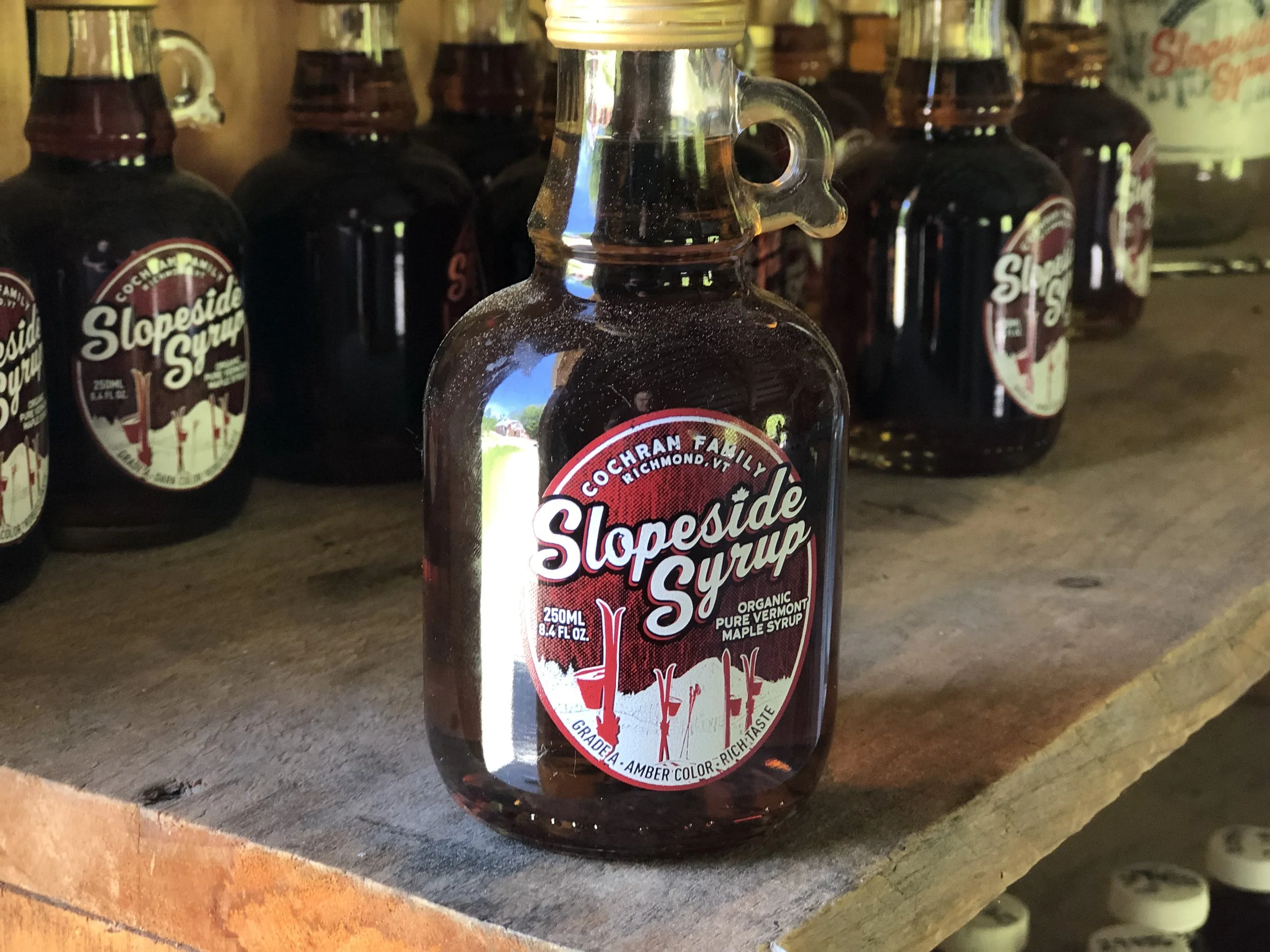
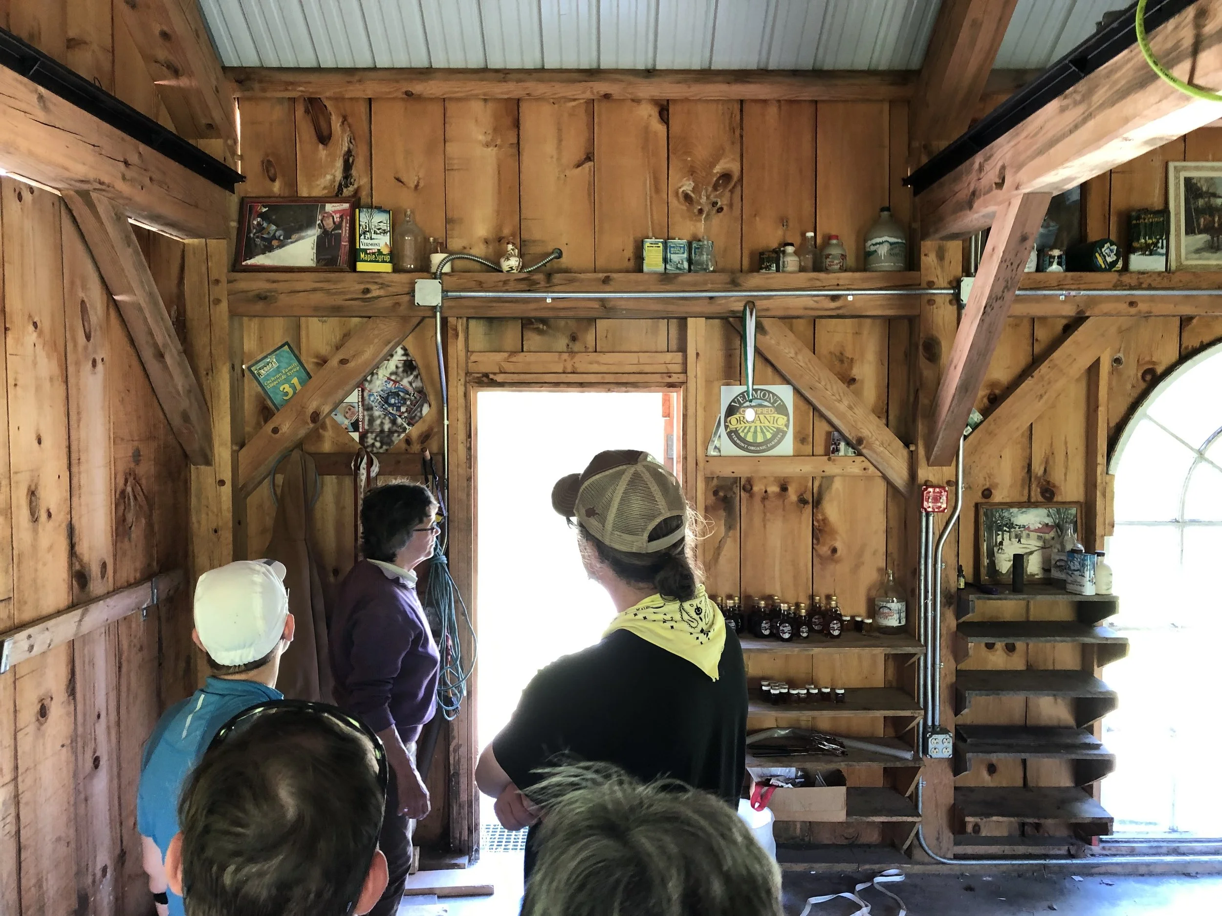
Cochran’s
Slopeside Syrup - Marilyn Cochran-Brown
Untapped
Prohibition Pig brewing
Prohibition Pig dinner
Ben & Jerry’s ice cream
Bill hit a pothole and locked up front brakes on climb
Big climb to Little River State Park campground - nice facilities
One Adirondack shelter
Bonfire
Full moon
We saw Jupiter and its moons with telescope
Visiting the Cochran Ski Area and meeting a legend
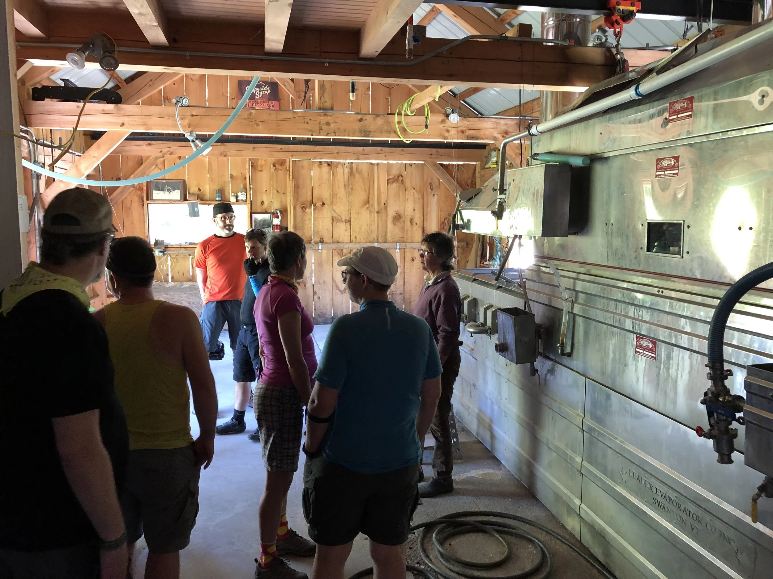
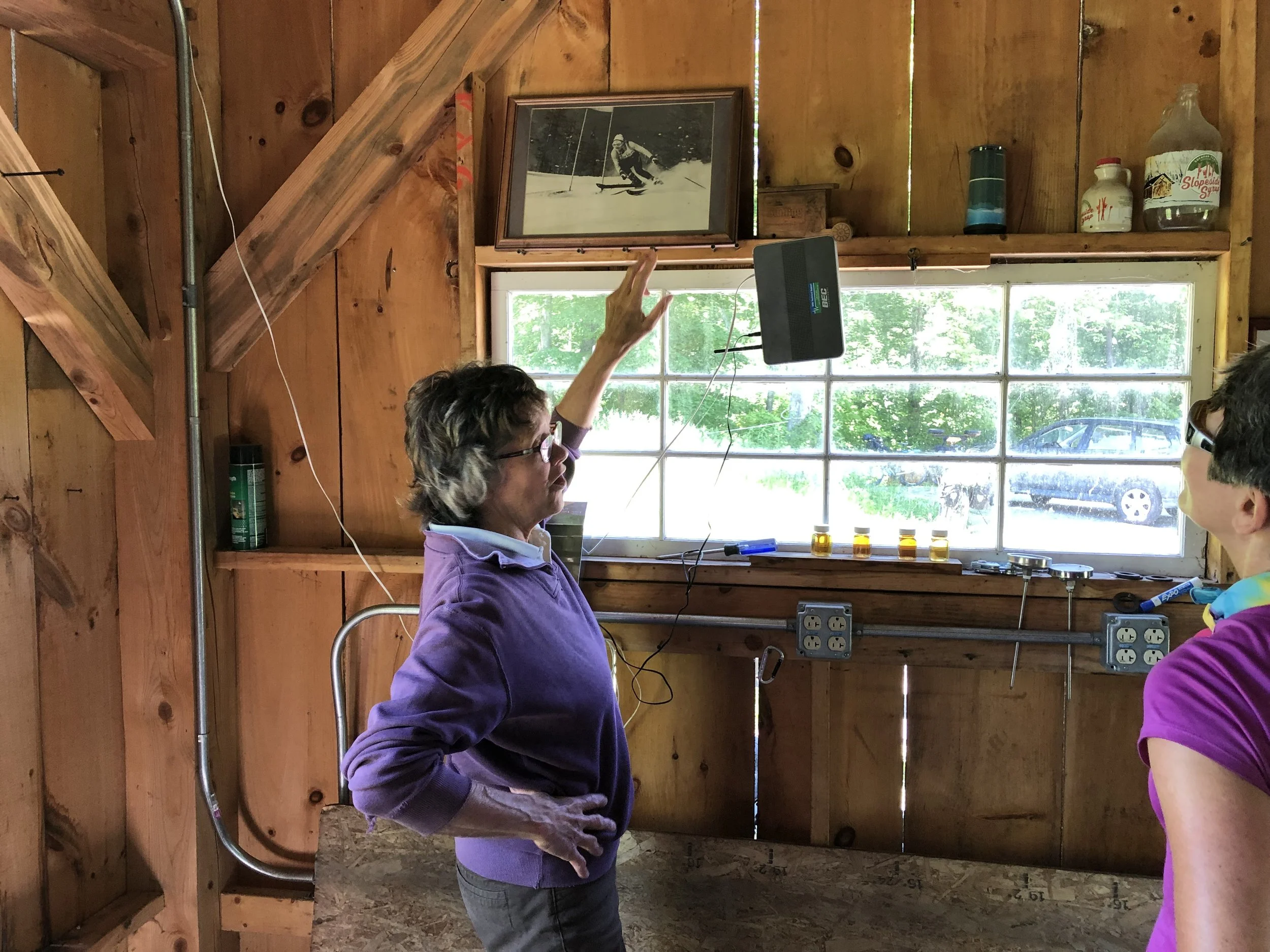
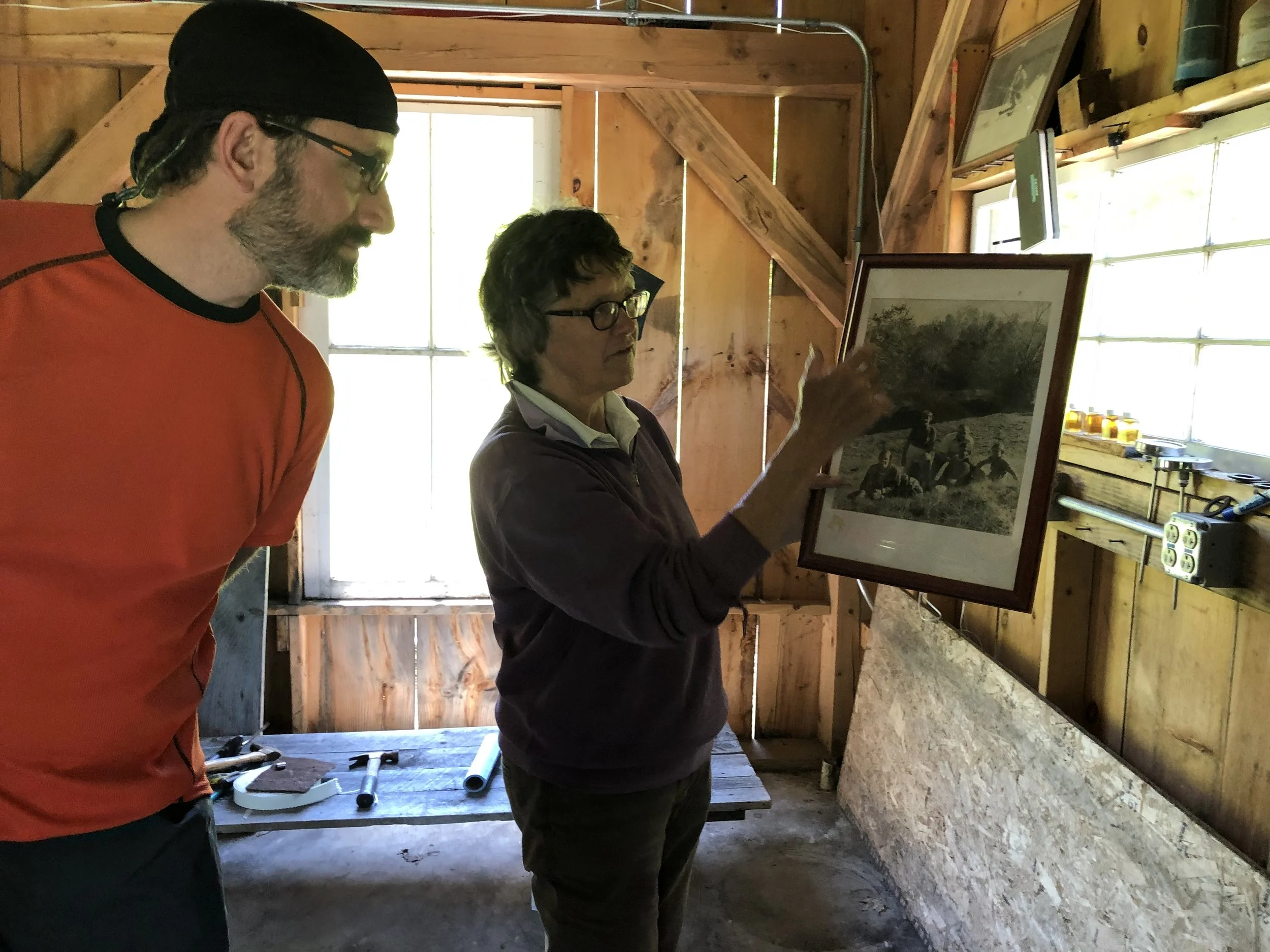
A month before our trip I reached out to Untapped to find out if they would give us a tour. Their facility was along our route after our lunch stop in Richmond, VT. On the day we visited Richmond we stopped for a delicious lunch at Sweet Simone’s. Afterward we ventured into Village Bicycle to look around and I made the call to Doug from Untapped. Unfortunately he was busy moving equipment but he said his mom Marilyn would meet us at Slopeside Syrup, the sugar shack facility at Cochran’s. After I hung up I mentioned her name to the bike shop owners and they replied, “she is a legend around here.”
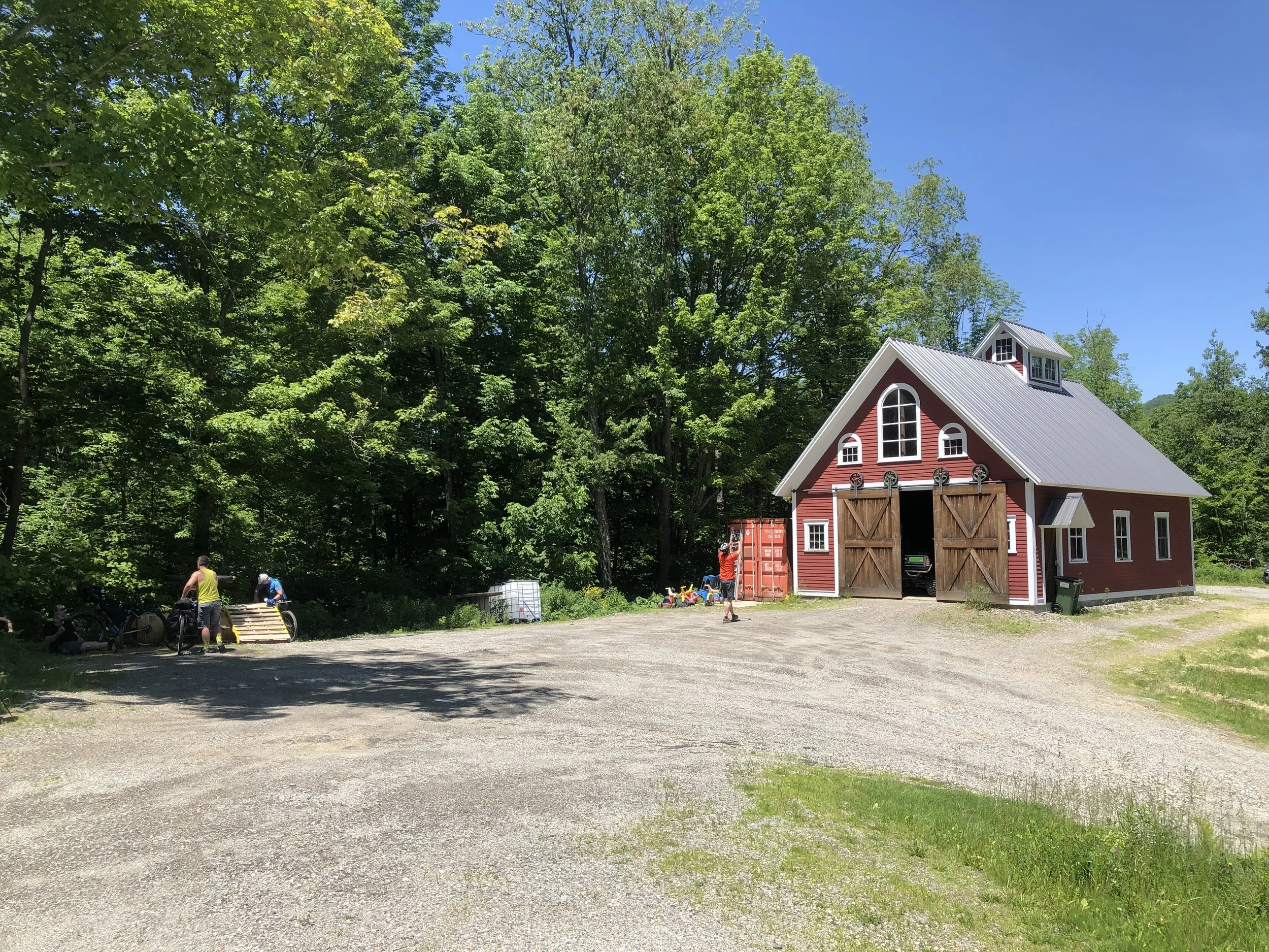
At the Cochran’s Ski Area we climbed the gravel road up to the sugar shack and sat in the shade until a Subaru pulled up the steep drive and a woman got out. She introduced herself as Marilyn Cochran and slowly revealed the rich history of Cochran’s and the Cochran family’s triumphs in downhill skiing through her storytelling. We learned that Marilyn was the first American woman to win the giant slalom in the World Cup and that she won a bronze medal in the World Championships the year after! So cool.
During the tour of the sugar shack Marilyn pulled out an issue of VT SKI + RIDE Magazine and showed us the story about Slopeside Syrup and pointed out that they attributed a gold medal to her. She giggled when she revealed that it was indeed her sister who won the gold medal at the Olympics. She went on to talk about the cousins and her children and how they were involved in the production at Cochran’s.
Finally, she took us over to the red barn and we toured the offices and climbed up the spiral staircase to the cupola. We saw all of the Untapped products being shipped from the facility, plus we all received samples of the various products before heading down the road. Big thanks to Marilyn for taking the time from her day to give us a tour and a lesson in US skiing history. We have become big fans of Untapped!
Day 2: Waterbury, VT (Little River State Park Campground) to Elmore State Park Campground

Stopping to take in the view • Photo credit: Ray George
Day 2 Quick Stats/Notes
Route: Waterbury, VT (Little River State Park Campground) to Elmore State Park Campground
39 miles // 3900 ft climbing
Original route: Day 2 route before landslide
Day 2 photos: Ray George
Day 2 photos: Tim Cristy
Maxi’s breakfast - it was hot inside
Alchemist Brewery samples
BBQ place next door for lunch
Gravel roads
Farm with self serve
Rock Art Brewery
Mountain pastures induce singing
Dinner at Elmore store
Elmore State Park
Facilities are dated
Three shelters
Bonfire
The hills are alive with the sound of music
Our original DAY TWO route was detoured because of the Foster Trail Landslide in the Mt. Mansfield State Forest. We still experienced some great gravel roads to reconnect with the original route in Stowe. In Stowe, we had to stop at The Alchemist to check out their latest beer offerings, including the famous Heady Topper. After lunch at the BBQ joint next door we climbed out of the valley and experienced why the von Trapp family moved to the area. The mountains combined with the fields of flowers inspired Nick to belt out a classic.
Day 3: Elmore State Park Campground to Allis State Park Campground

Hike-a-bike on class 4 town highway • Photo credit: Ray George
Day 3 Quick Stats/Notes
Route: Elmore State Park Campground to Allis State Park Campground
43 miles // 4800 ft climbing
Day 3 photos: Ray George
Day 3 photos: Tim Cristy
Breakfast at Elmore Store
Steep climb. Vince jammed his rear derailleur. Only Eva rode it. Lost heifers.
Class 4 town highway / Double track
Mike lost his pannier
Mike rode into a puddle
Nick flipped over handlebars into puddle
Lunch at Three Penny Taproom
Coffee at Capital Grounds
Onion River Sports stop
Rain showers
Red salamander on road
Big, big climb to Allis State Park
Three Adirondack shelters
Facilities are dated but nicer than Elmore
Pizza from Randolph Village Pizza
Fire tower hike - some of group
Small black bear sighting by Mike
The saga of the class 4 town highway
As we headed south away from Elmore State Park we turned onto a gravel road. This particular road progressively became more and more challenging. As we all know a downhill regularly leads to an uphill and the first major climb of the day brought us a jammed rear derailleur and a lot of walking from the group. We also learned from a farmer to be on the lookout for some lost heifers.
We passed some farms in the valley and the road began to slowly rise and passed logging operations and a few houses. The first hint of what was to come were the intersections with side “roads” that are designated snowmobiling routes. After a bathroom break we encountered the first of many rock gardens and double track, also known as a class 4 town highway in Vermont, i.e. no maintenance jeep road.
After several miles of slow riding, hike-a-bike and climbing we reached a large rock shelf where we stopped for a break. Mike looked at his bags and realized that he was missing a pannier! He headed back down the mountain and returned a while later with his bag that had fallen off at the bathroom stop. As the road leveled out the puddles in the stream got bigger and deeper. Mike ventured into one puddle that turned out to be a big mistake and he bailed by jumping up on the side of the road to escape fully submerging. Only a few minutes later a “hold my beer and watch this” moment occurred when Nick started down a slope above a puddle only to find himself in the puddle and his bike on top.
After a total of 4 miles on the jeep road we dropped down to the next gravel road with a broken pannier attachment and bruised egos, but otherwise unscathed. Onto Montpelier for lunch!
Day 4: Allis State Park Campground to Warren, VT (Hostel Tevere)
In the clouds at Roxbury Gap • Photo credit: Ray George
Day 4 Quick Stats/Notes
Route: Allis State Park Campground to Warren, VT (Hostel Tevere)
22 miles // 2400 ft climbing
Route note: We ended our day at Hostel Tevere due to thunderstorms instead of ending at Maple Hill Campground. On Friday we bypassed the route to Maple Hill and headed into Lincoln, VT.
Day 4 photos: Ray George
Day 4/5 photos: Tim Cristy
Breakfast in camp
Rain shower
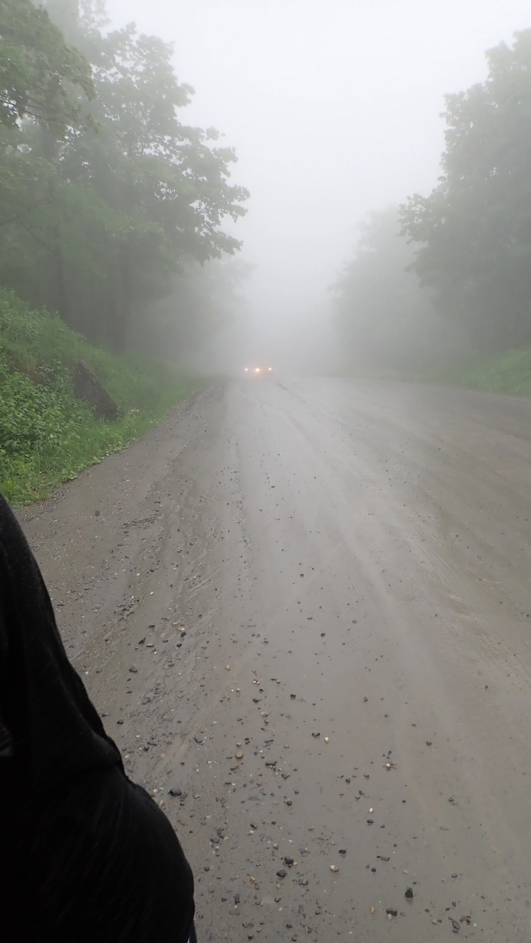
Roxbury Gap in rain and fog, stinging rain downhill
The Warren Store lunch
Generosity of public - man asked if we needed to be driven anywhere
Rain, thunder and lightning
Hostel Tevere
New owner
Restaurant/bar reopening soon
The Mad Taco burritos
Hung out in living room
Bill changed a flat
Roxbury Gap and the unexpected hostel visit
We woke to unsettled skies on day four and packed up camp. After dropping off the mountain from Allis State Park we headed out on the route. We warmed up on a steep slick gravel climb and ridge top scramble and descended into the town of Roxbury, VT. We turned right onto Warren Mountain Rd which turns into Roxbury Mountain Rd. at the top. As we climbed the rain picked up and we ended up in the cloud at the peak. The rain slowed down, but the temperature dropped so out came the jackets for the drop into Warren, VT for lunch. As we dropped down the rain picked up and stung our faces. Once we reached the bottom we regrouped and decided to move quickly to the Warren Country Store to warm up. Bill rolled in with a slow leak and a quick pump-up kept us moving.
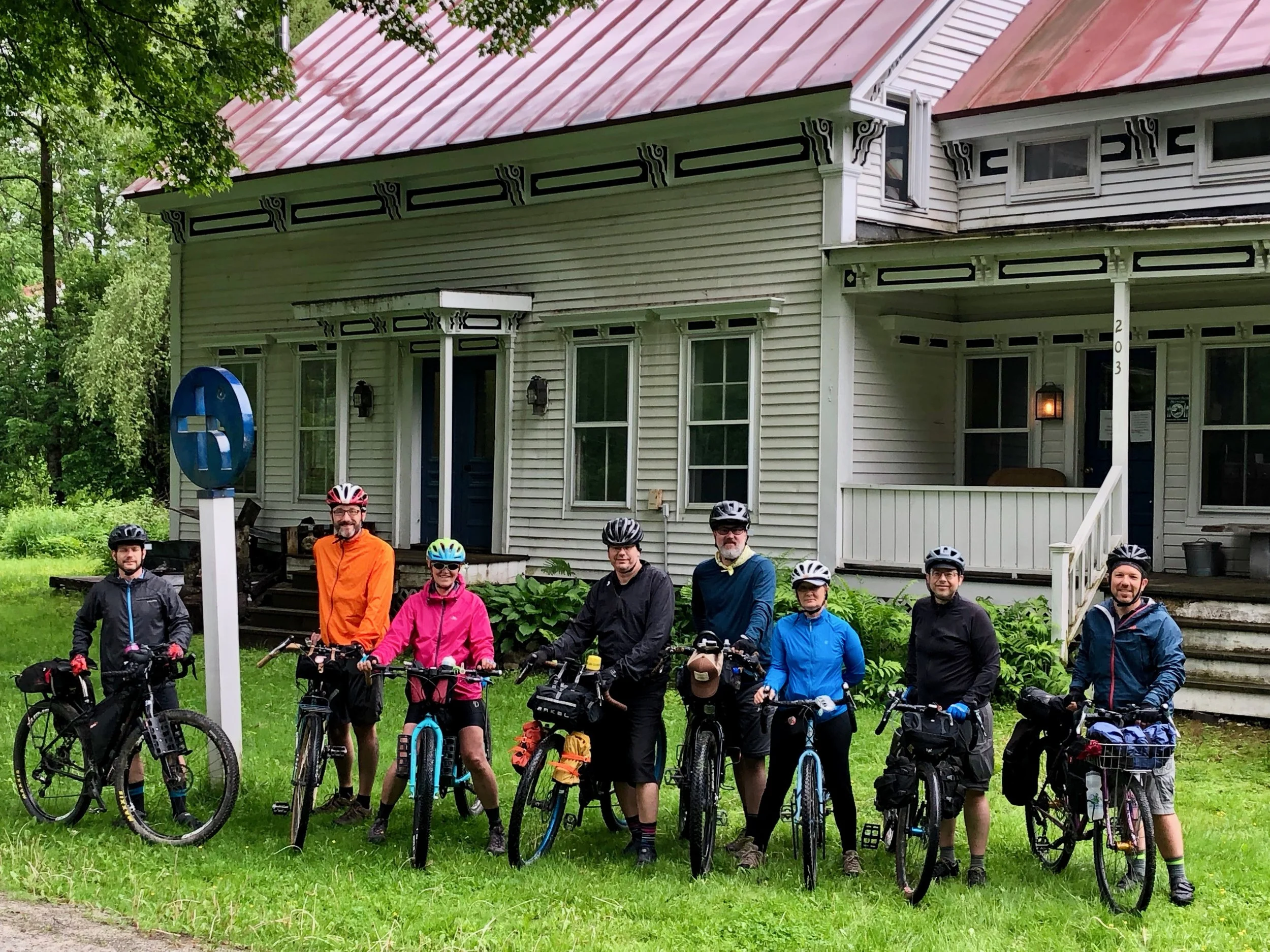
At the Warren Country Store we ordered lunch and hot drinks to warm up. Nick revealed that he was hypothermic on the downhill and needed dry clothes to warm up. We checked the weather and the forecast did not look good. The bulk of the rain was going to hit us as we headed up Lincoln Gap. After reassessing the route and accommodation options we called Hostel Tevere to check for availability. With a place to stay secure we headed out into the downpour for the mile and a half ride to the hostel. We rolled up soaked to the bone and cold.
Ryan, who recently acquired Hostel Tevere, welcomed us at the door. The group spread out among the many rooms and laid out our gear to dry it the best we could. After a warm shower some of us took naps or relaxed. It was a nice respite from the inclement weather. We finished out the evening with burritos from The Mad Taco.
Day 5: Warren, VT (Hostel Tevere) to Burlington, VT (North Beach Campground)
The group leaving Hostel Tevere • Photo credit: Ray George
Day 5 Quick Stats/Notes
Route: Warren, VT (Hostel Tevere) to Burlington, VT (North Beach Campground)
52 miles // 4000 ft climbing
Original route from Maple Hill Campground
Day 5 photos from Ray George
Warren Store breakfast
Covered bridge
Lincoln Gap climb
Eva, Mike, Mitzy and I rode entire climb
We took photos at top
Lincoln general store
Bristol lunch
Nature preserve
Bill had a flat
Headwind was rough
Fiddlehead beer - Greg and Mitzy rode to meet us
Pho Hong dinner
Mural photo
Creemee dessert
Trail ride back to campground. Jon stopped by
Raccoon checked into our camp and tapped my leg for food
Steepest paved mile in America
Our final day started with breakfast at the Warren Country Store. Once filled up with sandwiches and hot coffee we headed slowly up the road toward the Lincoln Gap. I pulled out my phone and played Eye of the Tiger for some inspiration and giggles from the group. The Lincoln Gap Rd became steeper the higher we climbed. It is the steepest paved mile in America with a consistent 20% grade. Four of the eight riders rode up the entire climb without any walking. Two of the four were still carrying the bulk of their bikepacking gear which weighed in roughly 25-30 pounds, We stopped at the top for photos and dropped down the other side toward Bristol for lunch. After lunch we faced a consistent headwind as we wound our way through the valleys back to Burlington.

20% climb up Lincoln Gap • Photo credit: Ray George